EURAC

EDP - MAPS platform

EDP-MAPS is an open source platform for sharing geospatial data and maps. Here you can upload your own datasets by yourself and set permission. The Platform is one component of EDP managed by the Center for Sensing Solutions of Eurac Research.

Find it online at EDP - MAPS platform.

EURAC
KMaP

KMaP

UNEP-MAP Knowledge Management Platform

KMAP is conceived as a unique access hub to e UNEP-MAP (Mediterranean Action Plan) knowledge heritage. It is composed by a Data Hub, collecting geographical data in broader sense, The Knowledge Hub, collecting all the UNEP-MAP documental heritage, and an Exchange Hub aimed to enforce the cooperation with UNEP-MAP contributors, stakeholders, citizens, and communities of interests.

Find it online at KMaP.

SCORE

SCORE Project Data exchange and publishing

This the platform of the SCORE project, a four-year EU-funded project aiming to increase climate resilience in European coastal cities.

Find it online at SCORE Project Data exchange and publishing.

SCORE
Po River Basin Authority

Po River Basin Authority

Geoportal of the italian basin authority of Po River

SDI of the basin authority of Po River, the main italian river, where all the public ecological, hydrological and hydrogeological information and thematic maps about the Po river area are published.

Find it online at Po River Basin Authority.

Treviso Province

Sharing data and maps of Treviso area

GeoNode SDI of the Province of Treviso

Find it online at Sharing data and maps of Treviso area.

Treviso Province
Thünen-Atlas

Thünen-Atlas

OpenData portal by Thünen-Institute

Since 2015, the Thünen Institute has made data on land use and animal husbandry in Germany publicly available in digital map sets at the municipal level. In 2016, we added maps on fisheries, forests and forest use. Also, in 2016, the Land Atlas was created as a comprehensive digital map application. The new Thünen Atlas combines all these digital applications and their underlying data inside a data portal providing metadata and web services.

Find it online at Thünen-Atlas.

Sustainable Caucasus

Supporting Sustainable Mountain Development in the Caucasus

This GeoNode instance has been developed in the frame of the "Supporting Sustainable Mountain Development in the Caucasus (Sustainable Caucasus)" project, funded by the Swiss National Science Foundation and the Swiss Agency for Development and Cooperation under the SCOPES Program, and coordinated by the University of Geneva.

Find it online at Supporting Sustainable Mountain Development in the Caucasus.

Sustainable Caucasus
GeoINTA

GeoINTA

National Institute of Agricultural Technology of Argentine

GeoINTA update as a SDI node and integration with different GIS tools of the Armed Institute based on INTA is current reality discovery to the different tools integration, providing centralized technological solution and decentralized functionality.

Find it online at GeoINTA.

GeoMOP

Public Works Argentine Republic is Ministry

National SDI for the management of public works of the Argentine Republic for its monitoring and management

Find it online at Public Works Argentine Republic is Ministry.

GeoMOP
SDI ECLAC

SDI ECLAC

UN - ECLAC

ECLAC SDI that supplies statistical viewers with information from Latin America and the Caribbean, integrating the SDI of the Americas.

Find it online at SDI ECLAC.

SDI Tres de Febrero Municipality

Buenos Aires province

Implementation Service of SDI-Cadastre Platform for the Municipality of 3 de Febrero.

Find it online at Buenos Aires province.

SDI Tres de Febrero Municipality
SDI Luján de Cuyo Municipality

SDI Luján de Cuyo Municipality

Mendoza province

3D platform is Installation with reference layers and rules engine with data from the Urban Code. IDE node for content management using the open-source software products GeoServer + Postgres + GeoNode. Data migration to the new portal. Installation of a workflow management and automation platform, Airflow

Find it online at SDI Luján de Cuyo Municipality.

Cadastre 3D San Luis

San Luis province

3D platform Installation and Geographic Information system that allows easy configuration of the geospatial portal and the authorized users can manage metadata catalogs served by the 3D platform

Find it online at San Luis province.

Cadastre 3D San Luis
Cadastre Neuquen

Cadastre Neuquen

Neuquén province

Updating and Modernization of the Cadastre Infrastructure System of the Provincial Directorate of Cadastre and Information of the Province of Neuquén

Find it online at Cadastre Neuquen.

AlpConv Atlas

Alpine Convention Atlas

The Alpine Convention Atlas is the repository where you can discover and browse the Alps' relevant data and information. It aims to collect, organize and disseminate the results of research activities carried out by the Alpine Convention and its Working Groups.

Find it online at Alpine Convention Atlas.

AlpConv Atlas
Geoportal OUOT

Geoportal OUOT

Observatorio Universitario de Ordenamiento Territorial (OUOT) - Universidad Nacional Autónoma de Honduras (UNAH)

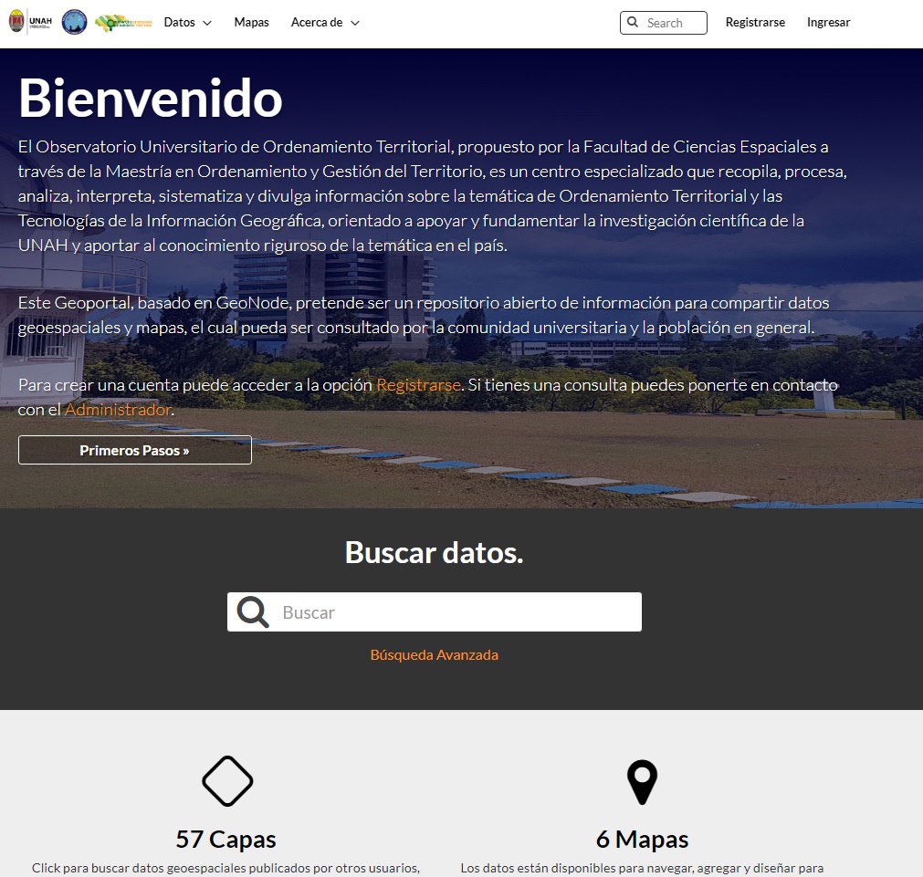
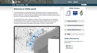
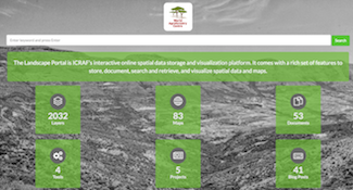
The University Observatory of Territorial Planning, proposed by the Faculty of Space Sciences through the Master's Degree in Territorial Planning and Management, is a specialized center that collects, processes, analyzes, interprets, systematizes and disseminates information on the subject of Territorial Planning and Geographic Information Technologies, aimed at supporting and substantiating the scientific research of the UNAH and contributing to the rigorous knowledge of the subject in the country.This Geoportal, based on GeoNode, aims to be an open repository of information to share geospatial data and maps, which can be consulted by the university community and the general population.

Find it online at Geoportal OUOT.

ARPA Veneto

ARPA Veneto Italy

Venetor Region - Agency for Environmental Protection (ARPAV).

Find it online at ARPA Veneto Italy.

ARPA Veneto
IW:LEARN

IW:LEARN

IW:LEARN Spatial Lab

The IW:LEARN Spatial Lab aims to provide a customizable mapping of the GEF International Waters (IW) portfolio and provide a visualization of studies, reports and intervention results on the various transboundary water basins pulled together with the help of the GEF IW projects, partner organizations and authoritative sources and other contributors.

Find it online at IW:LEARN.

ICRAF

ICRAF Geoscience Lab

TICRAF Geoscience Lab, uses Geonde as a spatial data sharing platform to meets its mission of applying GeoSciences in real decision contexts, such as climate change adaptation, hydrological effects of changes in climate and land cover, targeting of agroforestry interventions, provision of soil fertility and surveillance advisory services for smallholder farmers, digital soil and land use/cover mapping, and measuring impacts of interventions, all this using open source.

Find it online at ICRAF Geoscience Lab.

ICRAF
IGAD

IGAD

IGAD Spatial Web Portal

The Geoportal of the Intergovernmental Authority on Drought and Development

Find it online at IGAD.

CIGNo

National Council of Research ISMAR

The CIGNO (Collaborative Interoperable Geographic NOde) geoportal system is proposed to implement a system for heterogeneous multimedia data and metadata management (scientific and geographical, textual documents, tables, etc...). CIGNO can help users (stakeholders, administrators, scientists) to consult and exploit the scientific information provided by the ISMAR researchers.

Find it online at National Council of Research ISMAR.

CIGNo
HaitiData.org

HaitiData.org

The World Bank

HaitiData is designed toto facilitate open access to Haiti-related geo-spatial information, data and knowledge sources, encouraging others to share and use them for the development of Haiti. For a list of all the organizations and people involved in data collection for the site, see the partners page.

Find it online at HaitiData.org.

Dominode

Government of Dominica

Dominode is a geospatial data sharing portal operated by the Government of the Commonwealth of Dominica.

Find it online at Government of Dominica.

Dominode
BIOPAMA

BIOPAMA

European Union Joint Research Centre

The BIOPAMA project aims to build a solid information base for decision making on protected areas in the Africa, Caribbean, Pacific (ACP) region. This repository, based on GeoNode, is part of the BIOPAMA Reference Information System. Here you can discover and use maps, reports, data and other information sources, and upload your own to share with others. The themes of data you can find here cover a broad range of natural resource management and related topics.

Find it online at BIOPAMA.

RISKINFO

Disaster Management Centre of Sri Lanka

A public platform for GIS Data to support development in Sri Lanka. Developed in collaboration with WorldBank.

Find it online at Disaster Management Centre of Sri Lanka.

RISKINFO
Landscape Portal

Landscape Portal

World Agroforestry Centre Kenia

The Landscape Portal is ICRAF’s interactive online spatial data storage and visualization platform. It comes with a rich set of features to store, document, search and retrieve, and visualize spatial data and maps.

Find it online at Landscape Portal.